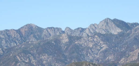
"La Ventana" ("The Window") viewed from south
with Kandlbinder peak (to left) & Ventana Double Cone peaks (to right)
(from Marble Peak Trail viewpoint, 11 miles southeast - J.Glendening)
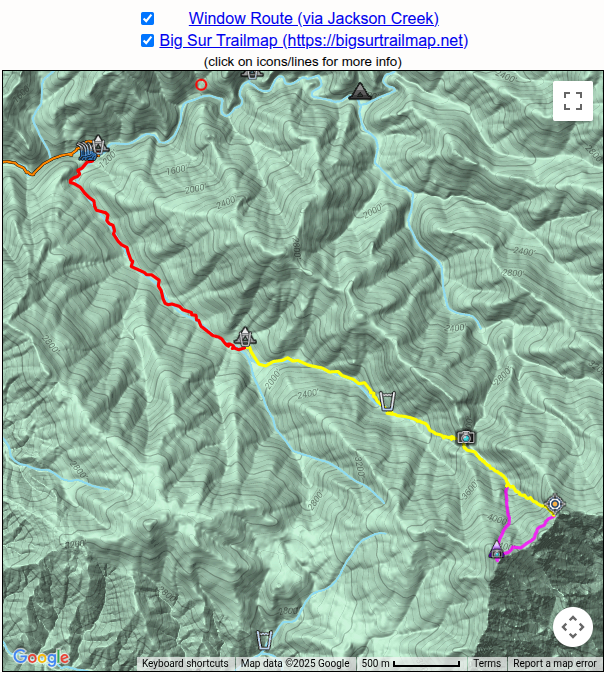
(click on icons/lines for more info)
This 2014 webpage is now out-dated, as the route has become increasingly difficult due to further degradation with time and lack of use.
In particular, the 2016 Soberanes Fire greatly impacted the route both by damaging it directly and by restricting hiker access to its trailhead.
This webpage now kept for its historical value and possible future usefulness.
2023 Update: For reports from an intrepid bushwacker who did reach "The
Window" in both 2022 and 2023, see: The Window via Jackson Creek
If you go: Would appreciate a report, with permission will pass info along.
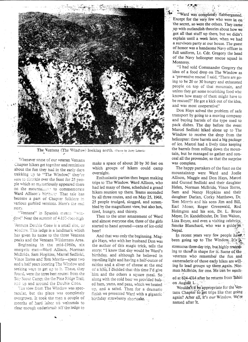
"La Ventana" or "The Window",
and sometimes "Ventana Notch", is the
distinctive 200 ft deep notch in the rocky ridge between Kandlbinder
Peak and the Ventana Double Cone (on left and right sides, respectively, of
photo on left). Supposedly it was named by Spanish explorers, becoming a
landmark which passed its name on to the surrounding wilderness area.
A legend claims that at one time a bridge-like slab crossed the top of
the gap to form a true window, but most doubt its validity.
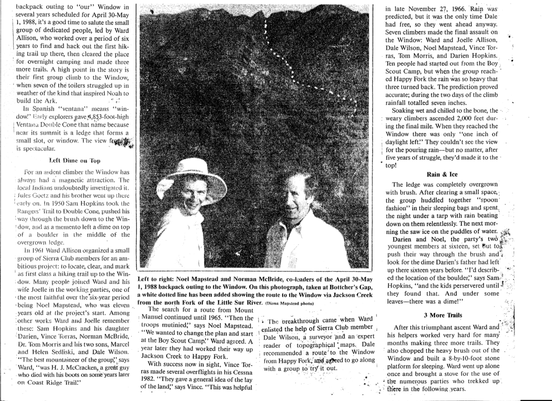
While undoubtedly it has an earlier history, known early ascents are
by Jules Goetz and his brother "early on" and Sam Hopkins in
1950. In 1961 Ward Allison organized a small group of Sierra
Club members to locate and clear a route up to the Window.
Initial explorations via Mt Manuel lasted until 1965, when lack of
success prompted a switch to a Jackson Creek route. A year later
they had reached "Happy Fork". Airplane overflights helped
establish the final ascent route and on November 27, 1966 seven hardy
climbers reached their goal in a heavy rain, unable to see the views
until after they had shivered through the night. As access
improved, others began climbing the Window to enjoy its magnificent
views and additional "Window routes" were established. The
culmination was a famous gathering on May 25, 1968, held in the Window
and reached by 25 people starting from a variety of trailheads with
final ascents coming from 3 different directions. A more
detailed history can be found in an article in a waterproof-box binder
at "The Window", which also contains the summit register.
The Route
Currently, in 2014, the Jackson Creek route is in poor condition. The old Sierra
Club "use trail" which ran along the northern side of Jackson Creek is
largely eroded and lost. The current route from Fox Camp starts
on the north side of Jackson Creek following that old trail, but then
winds back and forth across -- and sometimes in -- Jackson Creek,
following sparse tread and flagging. Downfall from windstorms
impeds passage and clutters up the creek itself - you must circumvent
the downed redwoods and step through large patchs of downed tan
oak. Trail finding and following abilities are required; backpacking is slow and tiring! In places multiple
usetrails exist. Eventually, at a confluence, you find Happy Fork Camp above a large cairn - it lies in a
flat area well above Jackson Creek so is easy to miss.
The route above Happy Fork Camp lies along a usetrail
(sometimes several, taken by different hikers) above and paralleling
the north side of the creek, never actually going into the creek (leave Happy Fork Camp heading north, not
towards the creek). That ends
at a line of cairns heading uphill from the creek ("Last Water" is 100 ft downslope of the first cairn)
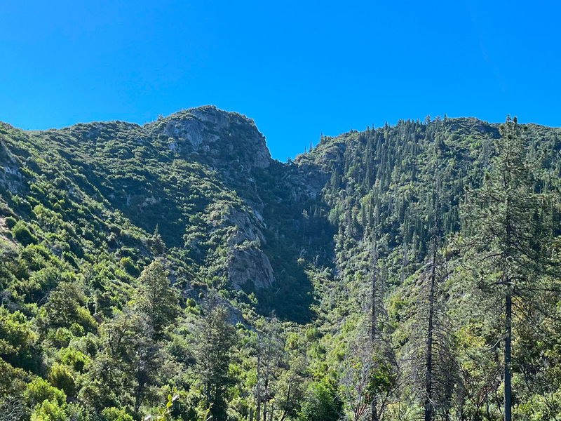
toward, but ending before, the "Saddle" - at which you finally see "The Window" ahead.
From the saddle, you descend beyond into a gully (a headwater of
the North Fork of the Little Sur River and possible water source after rains) which
can be followed to end in a talus slope reaching "The Window".
Alternatively, part way up the route a tall cairn marks the start of another talus slope which ends
at Kandlbinder peak (per Jan Doelman). From Kandlbinder, you can traverse
to gradually descend to "The Window" - but care is needed as
going either too high or low ends at cliffs (per Maria Ferdin).