Sierra Club Hike Description - October 16, 2010 Jack Glendening, Hike Leader
Last update: May 22, 2024
The eastern off-trail section of this route can be an enjoyable bushwhack if
a wildfire has recently burned the area but becomes increasingly difficult as brush overgrowns in later years.
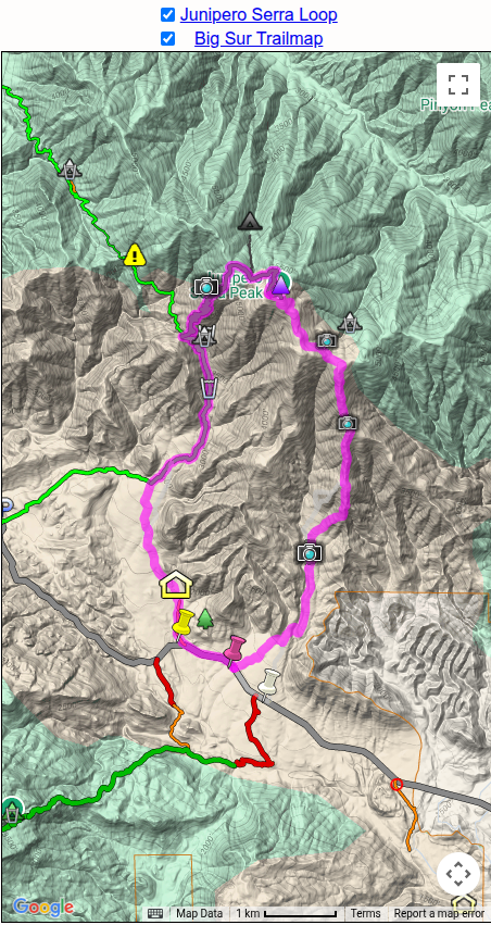
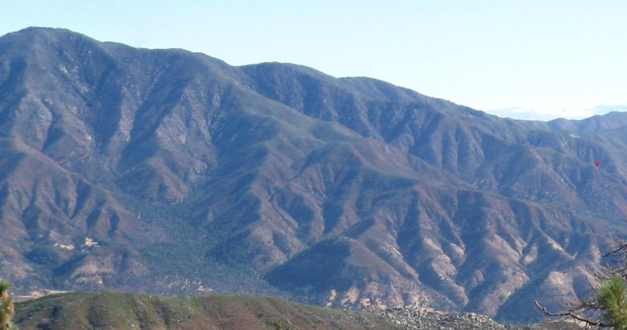
This loop hike climbs iconic Junipero Serra Peak, at 5857 ft the
highest peak in the Santa Lucia Mountains and in Monterey
County. (Also known as Santa Lucia Peak, its earlier
name, and Pimkolam, its Salinan name.)
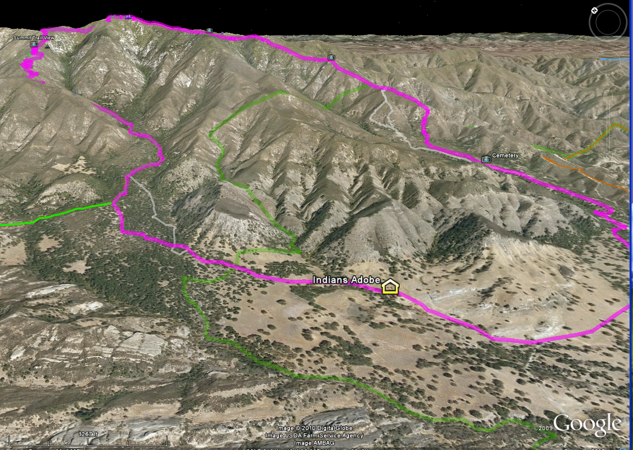
The route is overlaid in magenta on the adjacent display from the on-line Big Sur
Trailmap. We will ascend by bushwhacking along its eastern portion and
descend via the Santa Lucia Summit Trail. [Some alternative
routes I have investigated are also shown, in gray.] Note that
photos and additional information can be be viewed by clicking on the
icons along the route. The most difficult section occurs
on the ascent between 3100 and 3500 ft elevation, bushwhacking at an
average grade of 50%, which must be taken slowly - beyond lies
salvation, a reasonably brush-free firebreak of moderate slope
which extends all the way to the peak.
This hike is meant for experienced Ventana hikers who have already
ascended Junipero Serra via the official USFS in-and-out "Santa Lucia
Summit Trail" [the green line on the Trailmap insert, which can be
followed back its trailhead at Memorial Campground on Milpitas Road
and are now looking for a different way
of experiencing the mountain. It is for the adventurous hiker,
not the social hiker. It is a light-to-medium level
bushwhacking hike. I have previously hiked the route and
scouted several alternatives of which we will be taking the "best"
one, but much of the hike is off-trail, involves contact with and
pushing through some brush, steep terrain with occasional poor
footing, and you will get dirty. The hike is strenuous, with a
total distance of 11 miles and cumulative 4200 feet of ascent.
The hike will start at the trailhead at sunrise, and since the drive
to the trailhead requires 2 hours from Salinas it requires a very
early awakening and departure. The hike will finish around dusk
so the return drive will be after dark. One reason for the early
start is so that the pace will not be too rushed, allowing time for
photos, a rest on top, and exploring some features of interest along
the way; another reason is that conditions may have changed somewhat
since last year's hike, slowing the hike and producing a
later-than-anticipated return time.
As for any bushwhacking, wear clothes which can take abuse and which
can cover your legs and arms - they will get sooty from old burnt
Basin-Complex-fire vegetation. Gloves are a must. I've
found a wide-brimmed hat useful when going head-first through
brush. Gaiters should be considered. I do not recommend
the use of two poles, since one hand is often needed for holding onto
vegetation/rocks - but a single pole can be useful during the ascent
and descent. Water will not be available until the last 1/4 of
the hike - if it is a warm day, you should carry at least 2 liters of
water. I plan to have a late lunch, when we should be at a shady
spot with a view of Pinyon Peak, so if you anticipate getting hungry
prior to them bring along some snack food to tide you over. I
expect to complete the hike during daylight, but just barely, so
please also bring along a headlamp/flashlight in case we get delayed
and have to finish after dark. I also suggest bringing a camera,
since views along the route are wonderful :-)
Note: the route crosses a parcel of private property, the Chase Ranch -
I have obtained owner's permission to cross this property.

